There is a simple way to see Central Asia differently. Stop looking up. Look down.
In the older parts of Tashkent, Samarkand, Bukhara and many smaller towns, narrow channels of water can still run beside roads, through neighbourhoods and beneath the shade of trees. They may be easy to mistake for drainage ditches or an old-fashioned piece of urban infrastructure.
They are neither insignificant nor accidental. Known in many parts of the region as aryks or ariqs, these small irrigation channels belong to a much larger story: the story of how people made cities, gardens and agriculture possible in one of the world’s great dry regions.
For thousands of years, Central Asian societies have depended on controlling water brought from rivers, mountain streams and snowmelt. Water regulation is fundamental to the survival and prosperity of Central Asian populations, with traditional communities developing their own systems of water management and appointing specialists responsible for distributing water and maintaining canals.
The remarkable thing is that traces of this ancient relationship with water are still part of everyday life. You just have to notice them.
One of the easiest mistakes to make when travelling across Central Asia is to imagine the landscape as naturally dry and therefore historically difficult to inhabit. The reality is more complicated.
Some of the region’s most important civilizations developed precisely because people learned how to move water. In ancient Khorezm, irrigation canals drawn from the Amu Darya supported agricultural settlements and helped create the oasis civilization around the lower river. Irrigated agriculture appeared in the lower Amu Darya region by the end of the second millennium BC, with canals forming the basis for the development of ancient cities.
In the Fergana Valley, sophisticated irrigation systems developed around mountain rivers and streams. Archaeological evidence indicates that complex networks were already expanding during the first centuries AD. The cities that travellers visit today were therefore never simply placed in the landscape. They were engineered into it.
Spend time walking through an old Uzbek neighbourhood and you begin to notice a pattern. There are trees. Courtyards. Gardens. Narrow lanes. Walls designed to create shade. And, sometimes, water.
Traditional Uzbek houses were carefully designed for the local climate, with orientation, ventilation, irrigation and greenery helping create a more comfortable microclimate during extremely hot weather. Water was part of this logic.
The old city was not simply a collection of buildings surrounded by empty land. It was a living system in which water, shade, gardens, houses and streets interacted. That is one reason an apparently insignificant neighbourhood walk can reveal something that a major monument cannot.
The architecture begins to make sense. Modern Tashkent can feel like a completely contemporary city: wide avenues, high-rise buildings, shopping centres, busy traffic and enormous parks. But beneath this modern city is an older landscape.
The history of Tashkent is closely connected to waterways. Uzbekistan’s tourism authority notes that several canals, including the Konkus, Shirin and Darkhan, once flowed through areas that are now part of the city’s mahallas. UNESCO’s documentation of Tashkent’s traditional mahallas provides another clue.
Historic neighbourhood centres could contain a mosque, school, teahouse and hauz — a pond or reservoir — while water played an important role in the organization of community life. So when you walk through an old mahalla, you are not simply walking through an architectural district. You are walking through a system designed around people, shade and water.


Perhaps the most fascinating part of this story is that water management was not merely an engineering problem. It was a social one.
UNESCO’s History of Civilizations of Central Asia describes traditional water administrators known as mir-abs, responsible for water management and canal maintenance. Communities could have their own water managers, while an aryk-aqsaqal could oversee the aryk system.
That tells us something important about how these societies functioned. Water had to be negotiated. If one farmer diverted too much, somebody downstream could receive too little. If a canal became blocked, an entire community could suffer. If irrigation channels were not repaired, agricultural land could become unproductive. The canal was therefore also a social contract. Everyone depended on everyone else following the rules.
Visitors to Bukhara tend to remember domes, madrasas, minarets and trading streets. But the city’s monumental architecture existed within a much larger hydraulic landscape. Historical sources describe the construction of new ariqs, bridges, reservoirs and hauzs in and around Bukhara, particularly during periods of urban prosperity.
The famous pools and reservoirs were not decorative additions to an already functioning city. Water was infrastructure. It was economic power. It supported gardens, agriculture, households and public life. And it influenced where people could live.
This is why it is worth looking beyond the famous monuments when walking through Bukhara. The city was not built around its monuments. Its monuments were built inside a much larger system.
There is another reason water changes the experience of travelling in Central Asia. It changes the temperature. Anyone who has visited Uzbekistan in summer knows the difference between standing in direct sunlight and sitting beneath a mature tree.
Traditional urban landscapes understood this instinctively. Water made greenery possible. Greenery created shade. Shade made courtyards, streets and gardens more comfortable. The result was a very different kind of urban environment from the stereotypical image of an arid Central Asian city.
In some places, you can still experience it. Walk down a quieter street. Find a tree. Listen. The sound of running water can be surprisingly loud once traffic disappears. And suddenly the city feels much older.
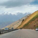
The relationship between water and settlement does not end in the cities. Travel towards the mountains of Kyrgyzstan or Tajikistan and the source of the water becomes increasingly visible.
Snow and glaciers feed mountain streams. Those streams descend into valleys, where they become essential for agriculture and communities. Today, however, this relationship is becoming increasingly fragile.
UNESCO reported in 2025 that melting glaciers and water scarcity are already affecting mountain communities in Kyrgyzstan, with farmers describing drying irrigation channels and springs.
That gives the old canals a contemporary meaning. They are not simply historical curiosities. They belong to a water system that remains essential.


The tradition is not limited to Central Asia in the narrow geographic sense. In Azerbaijan, the historic centre of Sheki also preserves evidence of traditional water infrastructure. UNESCO’s documentation of the historic city includes an aryk — an irrigation ditch — running along a street.
It is a small detail. But it reveals something about the broader cultural geography of the region. From the oasis cities of Uzbekistan to the mountain settlements of Azerbaijan, communities repeatedly adapted their architecture and daily life around the movement of water.
Political borders changed. Empires disappeared. Trade routes shifted. The logic of water remained.
Central Asia is often presented through its great monuments: the Registan, the Kalon Minaret, Khiva’s walls, ancient fortresses, caravanserais and Silk Road cities. But monuments are only the visible layer. Underneath them are systems. Water systems. Food systems. Craft traditions. Neighbourhood networks. Routes connecting villages and markets. Knowledge passed between generations.
These systems are often less spectacular than a blue-tiled dome. They are also the reason the dome could exist in the first place. The next time you travel through Central Asia, look for the water. Follow a narrow channel through a neighbourhood. Sit beneath the trees beside it. Ask your guide where the water comes from.
You may find that what looked like an ordinary ditch is actually a fragment of a system that helped create cities, agriculture and civilization across the region for thousands of years. And once you start noticing the aryks, you begin seeing Central Asia differently.
The monuments tell you what people built. The water tells you how they were able to live there.