This is a reimagined travel report from my journey along the Pamir Highway in the spring of 2024, inspired by the experiences shared by user vendigo1989 on LiveJournal. While there are countless accounts of adventures along this iconic route, another perspective is always welcome. The experiences and impressions gained while traversing the Pamir Highway can vary significantly based on the mode of travel, the time of year (as information can quickly become outdated), and the focus and mindset of the participants.

Geographically, the Pamir Highway stretches approximately 1,200 kilometers, linking the Tajik capital, Dushanbe, with the Kyrgyz city of Osh.
You can traverse this remarkable route in several ways:
Additionally, you must decide on your direction:
For those considering flights and car rentals, your journey begins with a flight to one of the capitals. Optionally, you might start your overland adventure from the Uzbek city of Samarkand or Khujand. Reports suggest that these options can be cheaper, so it’s worth monitoring ticket prices.
A Few Words About Car Rental with a Driver: Numerous Tajik travel agencies and private drivers specialize in Pamir trips. Price ranges vary significantly, with offers ranging from $1,200 to $2,200 for approximately 1,500 kilometers over six days (price for the vehicle).
This route is extremely popular among affluent Europeans, and the higher prices are tailored to this demographic. Negotiation is encouraged. I emphasized that I needed only transportation, without a comprehensive tour that includes accommodation and a guide. Prices are often calculated by the meter, so when discussing trip costs, it’s wise to specify the detailed route and approximate mileage. It is generally cheaper to contact drivers directly or work with intermediary managers.
Here are the contacts for the travel agencies I communicated with:
Additionally, I received contacts for individual drivers:
Ultimately, I traveled with Jandiya, who offered the most favorable price of $1,240. Most vehicles are similar—Toyota Landcruiser 100/200 models. Jandiya was a pleasure to communicate with and was eager to find solutions and compromises for any issues that arose.
It’s worth mentioning that for the first few days, Afghanistan will be on your right side during the drive, so the most photogenic and scenic spots will be on that side of the road.
As for continuing your journey in Kyrgyzstan, flying from Osh to Bishkek is the simplest option. Overland travel will take about 12 hours by taxi. For exploring the areas around Bishkek (Ala-Archa, Issyk-Kul), it is more convenient to rent a car independently.
Each traveler has their own pace and interests, so I can only recommend this itinerary as a basic framework. If I were traveling solo, I would have spent less time in Dushanbe and more in Kyrgyzstan. However, I had to adjust my schedule to ensure I arrived in Ishkashim on Saturday to visit the Afghan market (which was undoubtedly worth it).
It’s also crucial to pay attention to the road repair schedule; if you miss the window, you could be stuck for an entire day. It’s wise to set aside at least one extra day to account for mudslides and other emergencies in the mountains.
Overall, the journey along the highway was completed at a rapid pace, and an additional day or two would have been beneficial. However, conditions at high altitudes can be quite spartan, and I’m not sure everyone would be comfortable lingering there for long.
Visiting Afghanistan would undoubtedly be fascinating, but including it in this trip felt excessive. Despite the fact that several days of travel run alongside the border and Afghanistan is just a few hundred meters away, I genuinely had no idea what to do after crossing over. The Wakhan Corridor is clearly visible from the Tajik side, but it would feel odd to obtain a visa just to view it. Essentially, you would need to head overland toward Kabul, which would certainly require a separate journey.
However, obtaining a visa at the border is now easier than before. Entering through Tajikistan from the south via Dusti is now the only option, as entry through Khorog or Ishkashim is no longer permitted.
As for the possibility of crossing into Afghanistan by wading through the river or hopping across stones, it is physically feasible in many locations, but I would not recommend it in practice. The question remains: why? There isn’t much to explore in Wakhan, and just for a photo op, you could encounter significant problems and jeopardize the rest of your trip if you run into border patrols from either side.
A great way to meet, engage, and photograph Afghan locals is at the Afghan market in Khorog or Ishkashim, which takes place on weekends and is lively and colorful. No visas or permits are required—just a quick check-in at the entrance. However, there isn’t much to buy, as the goods are primarily Tajik, Chinese, and Iranian. The market caters more to locals than tourists; I even had to search for a traditional Pashtun outfit. I must note the friendliness and sociability of the people I met; foreigners are welcomed, offered treats, and are happy to take photos together.


There are several options for getting there:
The road was better than I expected and better than what taxi drivers had described. Many vehicles head to the lake, and hitchhiking is quite feasible, but for a day trip, it’s advisable to leave early to avoid getting stuck in the evening.
The journey to the lake takes about three hours. The trek to the waterfall takes around 40 minutes round-trip, during which you’ll encounter many unfamiliar plants and flowers. From here, numerous trails lead into the Fann Mountains.


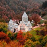
The Hisor Fortress is located 30 km from Dushanbe. The route is somewhat convoluted: you need to reach the Zarafshan bus stop in the west of the city, take a bus to Hisor (5 somoni), and then a shared taxi from the bus station to the fortress (7 somoni). Alternatively, you could simply take a taxi and share the cost if you have travel companions. There’s not much to see in the city itself, so it’s best to head straight to the fortress.
I explored the old and new madrasahs, the museum, and the fortress itself. The fortress is quite popular among locals and youth, where families stroll with their children, have photo sessions, ride horses, picnic, and even graze cattle. It’s interesting to climb the fortress walls and sit with a camera at the entrance.


We set off around 8 AM. Our vehicle arrived amidst a flurry of chaotic preparations. We spent a considerable amount of time sorting through a long chain of intermediaries—tour agent Jandiya, the driver’s manager Ibrahim, and finally the driver Boika—discussing who to pay, how much, and when (840upfront,400 at the end of the journey). We collected our GBAO permits.
It turned out we wouldn’t be stopping in Nurek, so I only got to see the reservoir from the highway. I regret not visiting the city, the second highest dam in the world, and the hydroelectric power station (which is officially closed to visitors, but I suspect arrangements could be made for a fee).

The Khulbuk Fortress was unexpectedly closed for renovations until the end of the year. The guard, who also served as the caretaker, refused to let me approach even for a photo. I had to settle for a visit to the museum while the others, feeling quite disappointed, opted not to go. The caretaker—an archaeologist, a PhD in history, and a veteran of the Afghan war—briefly conducted a tour for me, and we continued on our way, encountering a small traffic jam caused by herds of sheep and goats. Such delays, along with long lines of trucks, would accompany us for most of the journey.


In the afternoon, Afghanistan appeared across the Panj River, instantly uplifting everyone’s spirits. On that side, similar villages showcased the everyday life of the locals, indistinguishable from those on the Tajik side. Historically, this is indeed one valley. The ancient mountain principalities were only divided by the border drawn by Russia and Britain along the Panj River in the 19th century.
We entered the capital of Darwaz, Kalaikhumb, after the sun had dipped behind the mountains. “Darwaz” means “gate” in Persian, and indeed, this marks the true beginning of Gorno-Badakhshan. The village surprised me with its modernity: a state-of-the-art school in an unusual high-tech style (which, for some reason, had no children), several luxurious hotels, and contemporary monuments.


We departed at 4 AM to navigate the road construction zone before it closed. The road was absolutely dreadful; the jolting and bouncing made it impossible to even doze off, so it was wise to hold on to something in the vehicle. This was likely the worst stretch along the entire highway. According to reviews, the problematic section used to be longer, but perhaps the Chinese will soon upgrade this part as well.
Only after sunrise did we stop for tea at a teahouse and to explore the Vamar Fortress in Rushan. Locals from nearby houses can open the fortress for you, but part of it is occupied by border guards, so it’s best to avoid climbing over the barbed wire. Before the fortress was monitored, it suffered greatly from fires, wars, and the removal of materials by locals and military personnel.

My travel companions spotted an unguarded bridge across the river and decided to quickly dash into Afghanistan. They were sorely disappointed to learn that we had temporarily veered away from the Panj River; the river was actually the Bartang, and across it was yet another part of Tajikistan.

After lunch, we embarked on a trek to the village of Jizev. It takes about an hour and a half to reach, but not everyone made it. The path winds through a gorge and mountain trails, which can be somewhat monotonous. However, I enjoy trekking and was happy to stretch my legs after sitting in the vehicle. The village itself offers stunning views of the mountains, picturesque apricot blossoms, and kind locals who offered us tea. We expressed our gratitude by sharing some chocolate we had brought along. If desired, one can continue trekking further, even up to the glacier of the same name.


The main city of the Pamirs, Khorog, is also renowned for its high-altitude Botanical Garden (the second highest in the world after Nepal) and the hydroelectric power station below, which we visited in heavy rain and fading twilight. I had no energy left for photos. You can negotiate a reduced entry fee to the garden, but it’s best to avoid writing in the logbook.
In Khorog, the Pamir Highway diverges—the northern route (M-41) goes straight through the mountains, while the southern route continues along the Panj River and the Afghan border. The shorter northern road is primarily used by trucks from China and shared taxis.
For us, after a brief drive along the southern road to Ishkashim, the morning began with a visit to the long-awaited Afghan market. For a time, following the rise of the banned organization, Afghan markets were not held, but the tradition of trading on both sides in the neutral zone has now resumed.
The scale of trade and the number of people present were impressive. It resembled a local goods and clothing market, with some Chinese and Iranian products mixed in. Fruits were more expensive than in supermarkets. The bustling bargaining between Afghans and Tajiks created a vibrant atmosphere, but very few spoke Russian or English.
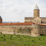
Beyond Ishkashim, the fortresses—outposts of the Great Silk Road from various eras—begin to appear. The walls of the ancient Kah-Kaha fortress (dating back to the 2nd century BC) are significantly damaged, but they offer a fantastic view of the Wakhan Valley. According to one theory, “kah” in one of the ancient languages meant fortress, and since this fortress consists of a fortress within a fortress, the name “Kah-Kaha” emerged.


The Yamchun Fortress is slightly older (also dating back to the 2nd century BC) and is located even higher, having been preserved much better. Its triangular shape corresponds to the peak of the hill. Two layers of fortified walls encircle the citadel, and round towers with narrow openings face down toward the valley. It’s possible that a Zoroastrian fire temple once stood within the fortress.


At the hot springs of Bibi Fatima, there are two halls—one where water flows naturally into a bathing reservoir, and the other where it is channeled through a pipe. Visits are segregated by gender. It is customary to enter the springs in the nude, and I was immediately admonished by one of the Pamiris when I attempted to change into swim trunks. In our case, the men went to the second hall while the women entered the first. The water is hot, at 45°C, making it challenging to stay in for more than 10-15 minutes. It is rich in various minerals and is considered therapeutic.
There are various legends about the origin of this spring, all linked to the daughter of the Prophet Muhammad—Bibi Fatima al-Zahra. It is also believed that bathing in the spring enhances fertility for women.
In the Muborak Vakhani Museum—dedicated to a local scholar, theologian, musician, and poet of the 19th century—you can find musical instruments, books he authored, and household items. Here, you can also learn about elements of traditional Pamiri homes.
Don’t miss the chilhona—a small stone house in the courtyard where Muborak prayed and meditated for 40 days and nights, cleansing his mind.
The solar calendar consists of four stone markers aligned in a row, positioned at different distances from each other, all oriented toward the sun. The first stone, with a small hole, is called the “solar stone” and is located in the courtyard of the house.


Evidence of Buddhism along the Great Silk Road is also present. The Buddhist stupa (dating from the 4th to 7th centuries) and the man-made cave grottos of monks near the village of Vrang are excellent spots to catch the sunset.


The name “Langar” has its roots in both Persian and Greek, deriving from the term “anchor,” which signifies “to drop anchor.” Historically, this term was used to describe places where caravans would pause during their travels.
Our morning commenced with a trek to the petroglyphs situated above Langar. The ascent is steep but rewarding, leading us to ancient carvings that speak volumes of the region’s history. Scattered along the mountain slopes are burial sites, including some modern ones, reflecting the Islamic traditions intertwined with remnants of pre-Islamic beliefs, evidenced by the horns and skulls of mountain goats found nearby.
The trail to the petroglyph site is short yet steep, revealing an abundance of ancient artworks. Unfortunately, many of these magnificent carvings have been marred by thoughtless visitors who felt the need to leave their marks atop these historical treasures. Among the depictions are goats, eagles, hunters with bows, riders, and various intricate symbols and patterns. While there is an optional second site with fewer carvings, I recommend dedicating your time to the first site and soaking in the surrounding natural beauty.

Next on our itinerary was the Ratm Fortress, dating back to the 3rd-2nd centuries BCE. Despite its location along a major route, it remains relatively obscure among travelers. The path to the fortress is not immediately obvious, winding through picturesque fields. The ruins themselves consist of piles of stones and shapeless remnants of walls. However, the views from one side of the fortress over the valley and the precipice above the river are truly breathtaking.


Leaving Langar, the road veers away from the Wakhan Corridor, Afghanistan, Pakistan, and the peaks of the Hindu Kush, beginning the ascent to the plateau. As we bid farewell to the Panj River, we spotted a caravan of nomads (possibly Turkmen) traversing the opposite bank. We waved, and the men rushed down to the river, eager to approach us and perhaps even cross for a friendly exchange.


As we climbed higher, the weather took a drastic turn; the temperature dropped, clouds rolled in, and a snowstorm ensued. Visibility worsened, and the wind outside the vehicle was strong enough to knock you off your feet. Despite the slow progress, we eventually reached the lakes, pausing for tea in a yurt hosted by kind locals in the village of Bulunkul. Entry to the lake area incurs a fee, as it is a protected zone (50 somoni per vehicle). As the sun peeked through the clouds, we settled down for lunch by another warm spring.


The journey to Murghab was long, punctuated by frequent photo stops. Essentially, this stretch of the highway is characterized by a high-altitude, lifeless desert, where the occasional shepherd tends to their flocks. At times, solitary figures could be seen traversing this barren landscape, presumably heading toward one of the few encampments.
We had now reached the peaks of the Pamir Mountain Range.

In Murghab, one could easily linger a bit longer—perhaps to visit the local market or catch a glimpse of the statue of Lenin, which stands at an impressive altitude.
The M-41 highway converged with the route through Wakhan, and we encountered a diverse array of auto and motorcycle travelers, all sharing the same goal of reaching the Kyrgyz border. Among them were Europeans, Chinese, and Russians. The border with China is just a stone’s throw away, with the road to China diverging immediately after Murghab, where all the trucks head as well. Occasionally, remnants of old Soviet border markers and sections of fencing could still be spotted.
Our plan for the day was refreshingly simple: cover the 150 kilometers to Karakul Lake, find suitable accommodation, and enjoy a stroll by the lake before attempting the Ortoboz Trek. Anticipating a well-deserved rest after our previous adventures, our driver Boika took his time on the good road.


However, we inadvertently missed the sign at the highest point of the route, the Ak-Baital Pass (4655 meters). The pass was blanketed in snow, creating a stunningly beautiful landscape.


Upon reaching Karakul, we encountered a challenge—only two guesthouses were open. One was hosting a celebration, and while we received an invitation, staying there was not an option. We settled into the other guesthouse and set out for a walk.

Our plans to ascend Ortoboz fell through. Upon reaching the village, the driver informed us that he was running low on fuel and could not take us the additional 25 kilometers to the start of the trek, no matter the offer. It became evident that he was simply unwilling to make the effort, preferring instead to spend the rest of the day relaxing and listening to music on his phone. By this point, I had grown weary of his reluctance to engage in conversation or understand the needs of paying customers, coupled with a sense of apathy and sluggishness. Why not fill the tank and bring an extra canister while there were still gas stations around? While our travel agent Jandiya had been pleasant and attentive, Boika and his manager Ibrahim seemed to share a mutual indifference.
Yet, even a simple stroll through the village, surrounded by the uniform white clay houses, brought immense joy as I took in the otherworldly landscapes that enveloped us. This was the heart of the Pamirs, one of the highest and harshest settlements on Earth. The Roof of the World. Even Murghab appeared more inhabited in comparison. It was decided that we would spend the remainder of the day here.
Despite being situated in Tajikistan, Karakul is predominantly inhabited by Kyrgyz people, just like Murghab. After sorting out our accommodation, we accepted an invitation to the celebration. Initially, someone mentioned it was a wedding, but we later learned it was a sunnah—a circumcision celebration for the son of the hosts. We were immediately welcomed to the table, where the feast consisted mainly of rich meats—broth, liver, fat, and lamb—alongside baursaki and sweets. The locals traditionally present gifts of money to the hosts, and after the meal, they take a portion of the food home with them.
The sight of flocks of sheep and yaks against the backdrop of the mountains and the lake was mesmerizing.


The saline waters of Lake Karakul (Black Lake, in Turkic) lay beneath a layer of ice, postponing dreams of a refreshing swim. The lake sits at an altitude of 3914 meters above sea level.

We set off early, with only 50 kilometers of good road to the border. Eager to reach our destination quickly, as we were uncertain about what lay ahead, we crossed the border without even stepping out of the vehicle for passport control and inspection. Our driver collected our passports and permits, returning them stamped and ready for departure.
A border guard joined us in the vehicle as we entered the neutral zone, where we were met by a car bearing Kyrgyz license plates. The officer ensured we were on our way before turning back.
The road through the Kyzyl-Art Pass was particularly treacherous, with muddy conditions. The mountain rocks here are a striking red (kızıl means red in Turkic). Patches of snow lingered in the shadows.
After traversing several more passes, we began our descent into the lush, warm valleys of Kyrgyzstan. In just three hours, we arrived in Osh, encountering herds of horses along the way, both on the road and in the hills.
Descending from the high, cold Pamirs, we finally had the chance to relax. Here, civilization awaited us.
Crossing into Kyrgyzstan from Tajikistan immediately instilled a sense of freedom and relief. It’s difficult to dissect this feeling into components; it’s simply a subjective experience.
Osh is the quintessence of a Central Asian city, often referred to as the southern capital of Kyrgyzstan. One of the oldest cities in Central Asia, it boasts a history of around 3000 years. The bustling atmosphere, with its enormous market (even after being divided into sections), is a highlight. Many Soviet mosaics still remain, and prices are incredibly low. The city itself has a somewhat provincial feel, appearing slightly conservative and as if it has been stuck in time for the past twenty years. I was surprised to learn that the Yak-40 in the park had been dismantled, making it unnecessary to visit.
Aside from the Jayma Bazaar, there is only one must-see attraction in Osh: Suleiman-Too (also known as Solomon’s Throne). However, one could easily spend an entire day there, from morning until evening. It’s best to plan your route to ascend from one side (the entrance near the mausoleum of Asaf ibn Burhiya is free) and descend from the other. One entrance is known as the Gate of Fire, while the opposite is the Gate of Water. Climbing the hill in the heat can be quite challenging, yet streams of visitors, including many elderly people, seem undeterred.
Suleiman-Too, a mountain revered throughout the ages and across various religions—including Zoroastrianism, shamanism, and Islam—serves as a spiritual haven for many locals who come to pray, perform rituals, or simply spend time with friends. The mountain offers breathtaking panoramic views of the city and its surroundings, alongside a museum nestled within a grotto, intriguing caves, and the opportunity to climb all five of its peaks.
The petroglyphs adorning the slopes of the mountain are more abstract and complex than the familiar scenes of hunting or animals, making them challenging to interpret. These ancient carvings are not always easy to see, as many have been obscured or painted over.
At Babur’s House, Kyrgyz visitors occasionally come to pray, concluding their rituals with the traditional gesture of “omen,” as if washing their faces with their hands. Legend has it that Babur built a mosque over the stone where the prophet Solomon prayed, leaving behind marks from his feet and head. Numerous stones in the area are shrouded in legend and are believed to possess healing properties, each with its own specialization. The most popular stone, known as Bel-Tash, is said to cure joint and spine ailments if one slides down it three times, resulting in the polished edges worn smooth by the bodies of countless pilgrims. To partake in this tradition, one must descend strictly on their back, with both young children and the elderly gleefully sliding down like playful youngsters.
As I reached Osh, the conclusion of the Pamir Highway, I reflected on my journey.
Typically, I strive to dispel prejudices during my travels, as that is part of the experience. However, my interactions with Tajiks along this route proved challenging at first. They are perhaps the most difficult people to communicate with in all of Central Asia. Many seem somber and unhurried, often slow to grasp what is being asked of them, and they tend to approach tasks with a lackadaisical attitude. While one can adapt to this over time, it’s essential to be prepared or to allow extra time for adjustment.
The Gorno-Badakhshan region is home to a diverse array of ethnic groups, including Shugnans, Rushans, Yagnobis, Bartangis, Orshorans, Yaskulem, Ishkashimis, and Wakhanis. Due to the rapid pace of my journey, I lacked the opportunity to conduct a detailed comparison among them. One thing is clear: the higher one ascends into the mountains, the happier, more carefree, and more welcoming the people become, their smiles growing broader. This is surprising, given the harsh conditions they endure. I hope these individuals never descend to Dushanbe in pursuit of hollow success.
Finding accommodation in Dushanbe can be quite challenging, as the city is just beginning to develop its tourism sector. This effort often comes across as earnest but somewhat clumsy.
Along the highway, conditions improve slightly. If traveling with a driver, they may know some places (though not always) and can take you to suitable accommodations based on your requests. However, they might also opt for the cheapest or most profitable options for themselves, which could lead to uncomfortable stays. It’s wise to discuss the possibility of changing accommodations in advance if the initial option does not meet your expectations. Avoid making prepayments or reservations; the supply of accommodations far exceeds demand in this area. If in doubt, don’t hesitate to ask locals for recommendations; you won’t be left without a place to stay.
Typically, dinner and breakfast are included in your accommodation. Bargaining is not just acceptable but encouraged.
As you ascend in altitude, the comfort level of accommodations diminishes, but I did not encounter anything too dire. Toilets and showers were available almost everywhere, except for the final night at Lake Karakul, where I opted to forgo a shower for the last two of five nights. Overall, I had braced myself for worse conditions.
In Kyrgyzstan, accommodation is a breeze: booking options abound, and the hospitality is commendable. During the off-season, with fewer visitors, it’s often unnecessary to book in advance. You can negotiate prices on-site, using the base price from booking platforms as leverage, since renting directly avoids commission fees.
The menu is characteristic of Central Asia, featuring dishes such as shashlik, kebabs, manti, plov, shurpa, lagman, and samsa. Due to religious customs, pork is, of course, absent.
Among Tajik national dishes, kuru-tob stands out—an enormous, rich, yet delicious meal. Dugh, a sour milk drink, is also popular.
At higher altitudes, you’re more likely to encounter yak meat than beef. In Murghab, you can even find ice cream made from yak milk. Starting from Murghab, a significant portion of the population is Kyrgyz, and you’ll come across their traditional foods, such as kurut and baursaki. On the Pamir, you’ll find shirchoy—a high-calorie tea made with milk, salt, and butter, popular in high-altitude regions.
In Kyrgyzstan, national drinks like maksym—a slightly sour beverage made from barley, wheat, millet, and corn—and chalap, a diluted ayran, are readily available.
Both Bishkek and Dushanbe offer a wide variety of dining options, from restaurants to traditional tea houses and cafes. You can utilize good old-fashioned ratings on Yandex and Google Maps to help guide your choices. Along the highway, you’ll primarily find cafes and markets. I recommend relying on local advice and the popularity of spots among residents. If locals frequent an establishment, the chances of foodborne illness are significantly reduced.
Throughout my journey, I did not encounter any serious digestive issues, although some travel companions were less fortunate. Sanitary conditions were poor, even more so than in India, where one could avoid such situations with some effort. Here, there’s little room to escape. Jokes about karma were relevant throughout the trip.
It’s wise to carry soap, hand sanitizer, and other hygiene essentials. The question of soap and handwashing often leaves locals perplexed, as they seem to possess a 100% natural immunity.
For snacks and treats, it’s best to stock up in Dushanbe or Khorog, as options become increasingly limited as you venture further. You can also toss a case of water in the vehicle, but it’s unnecessary to buy enough for the entire trip; simple shops exist in every settlement. I read in a report about someone who bought water for the entire journey in Khorog, only to distribute the leftovers to everyone from the driver to the hotel staff in Osh.
Daily expenses along the highway amount to approximately $15-20 for accommodation, plus meals and personal expenses.
Despite the challenges noted in this report, I emerged from this journey with a profound sense of awe and exhilaration. A week-long adventure filled with emotions, experiences, diverse atmospheres, and breathtaking landscapes is bound to leave no traveler unsatisfied or indifferent. In many ways, the Pamirs feel like a different planet!
As with all my travels, I attempted to cram as many points of interest into a minimal timeframe. Only by racing through the itinerary can one truly appreciate the experiences and lament the time lost that could have been spent in deeper exploration, engaging with locals, and savoring the journey. Someday, I hope to learn to travel without a rigid plan.
I must mention that I regretted opting for a rented vehicle with a driver. Almost everyone I met who traveled by hitchhiking expressed delight in the kindness and friendliness of the Pamiri people. This mode of travel allows for interactions with various individuals, a vital aspect of any journey. In contrast, choosing a vehicle ties you to a single driver, limiting your experience to their company for most of the trip. If you happen to have an unfortunate experience with your driver (as we did), it can diminish the overall positivity of the journey. Nearly everyone who traveled in rented vehicles reported similar issues to mine. After the borders open, I would recommend forgoing the race for destinations and instead spending your time hitchhiking or traveling in your own vehicle.
With all honesty, I doubt I will ever return to Tajikistan and the Pamirs in this lifetime. The world is vast, filled with countless intriguing places. May this report help fellow travelers conserve resources during their preparations, set realistic expectations, and genuinely enjoy the beauty that surrounds them.